Pai Canyon
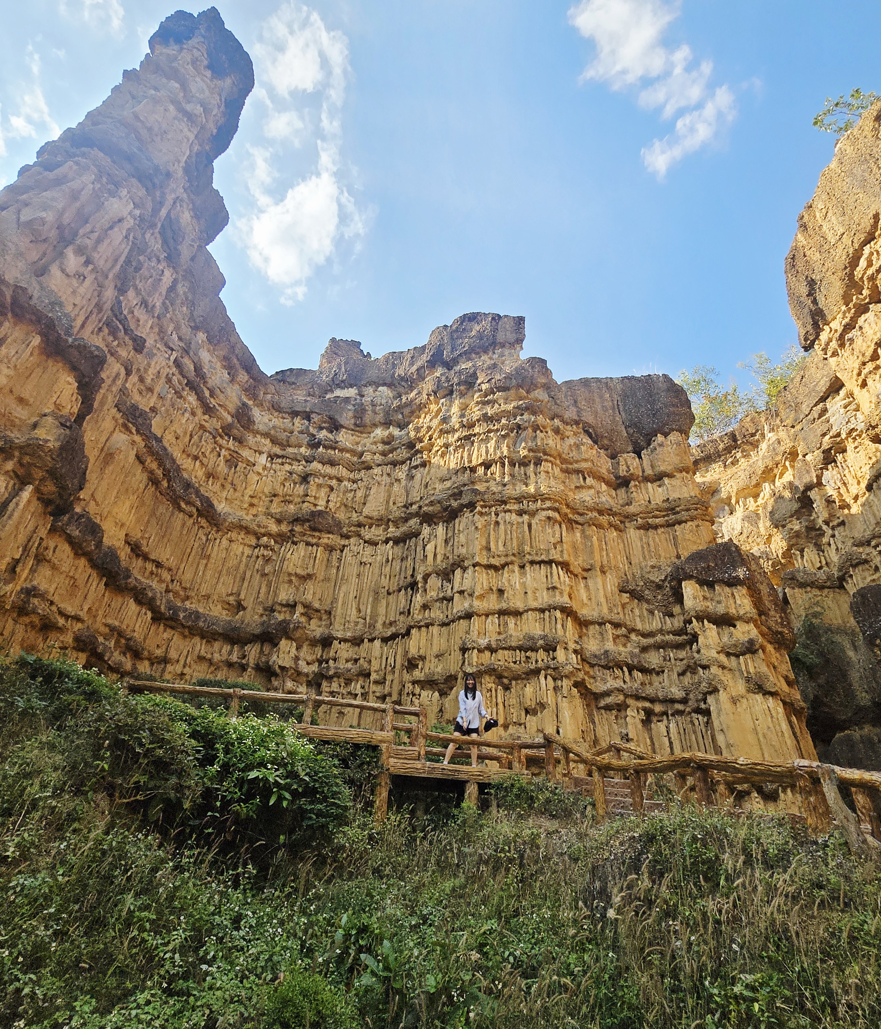
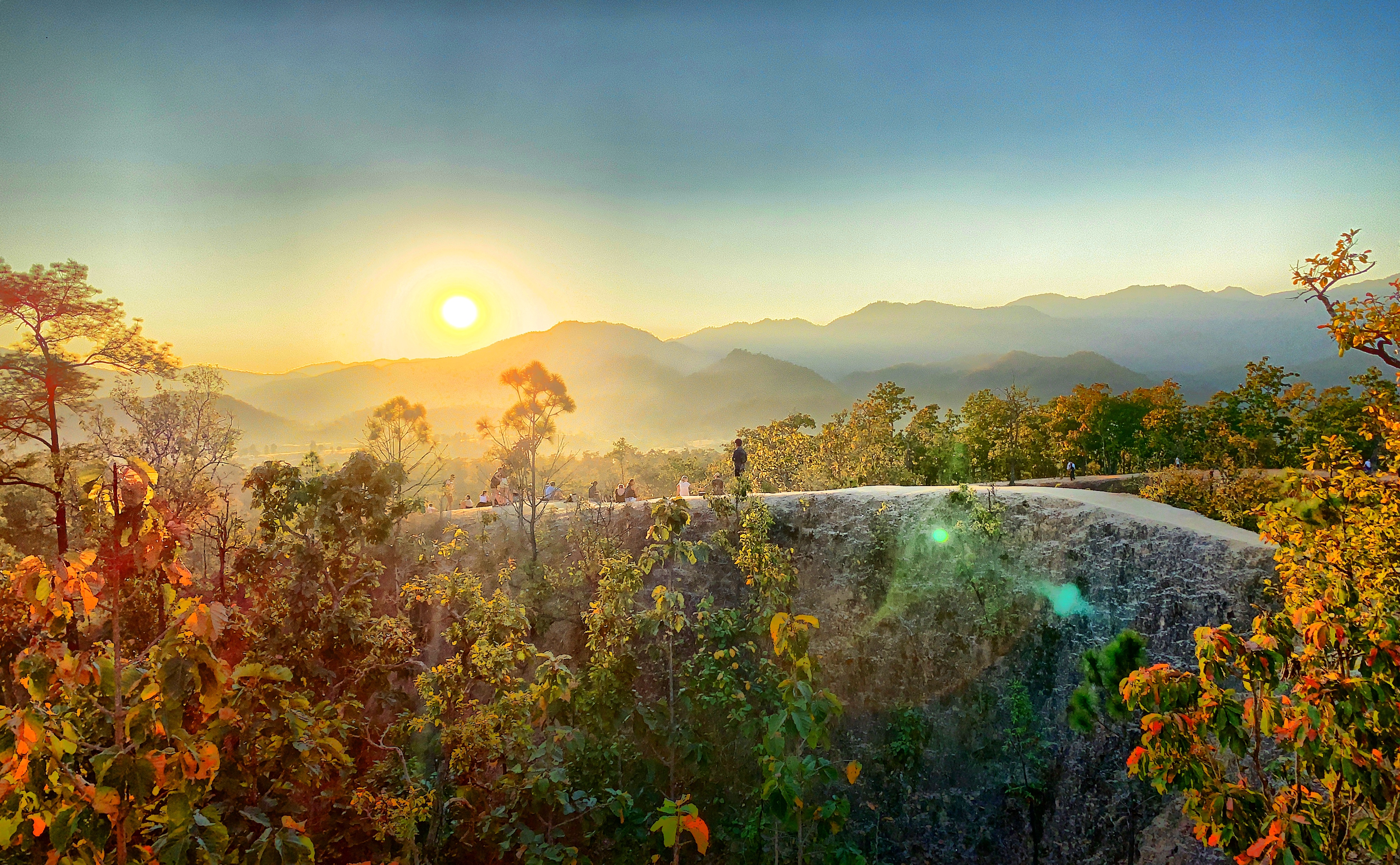
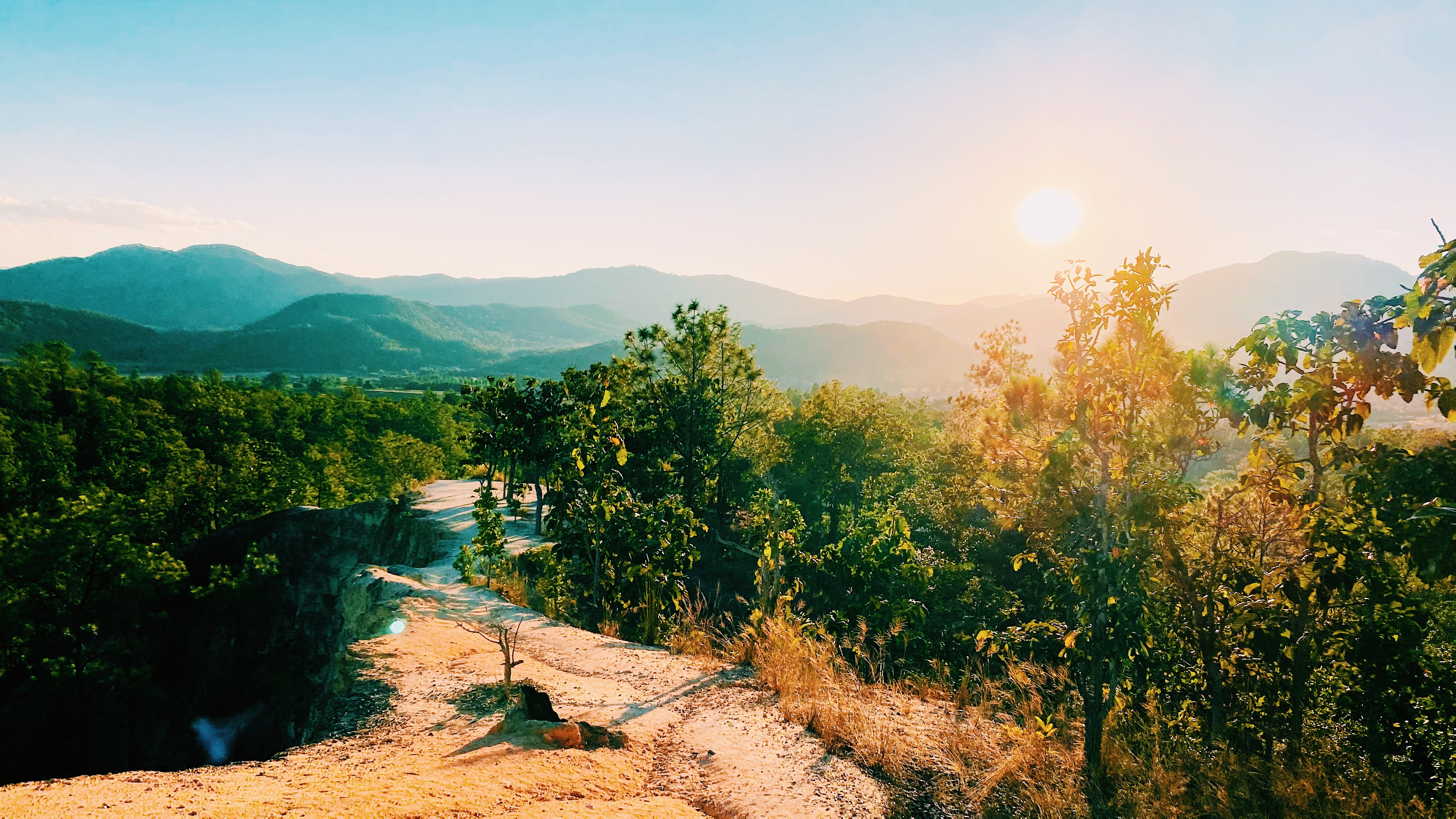
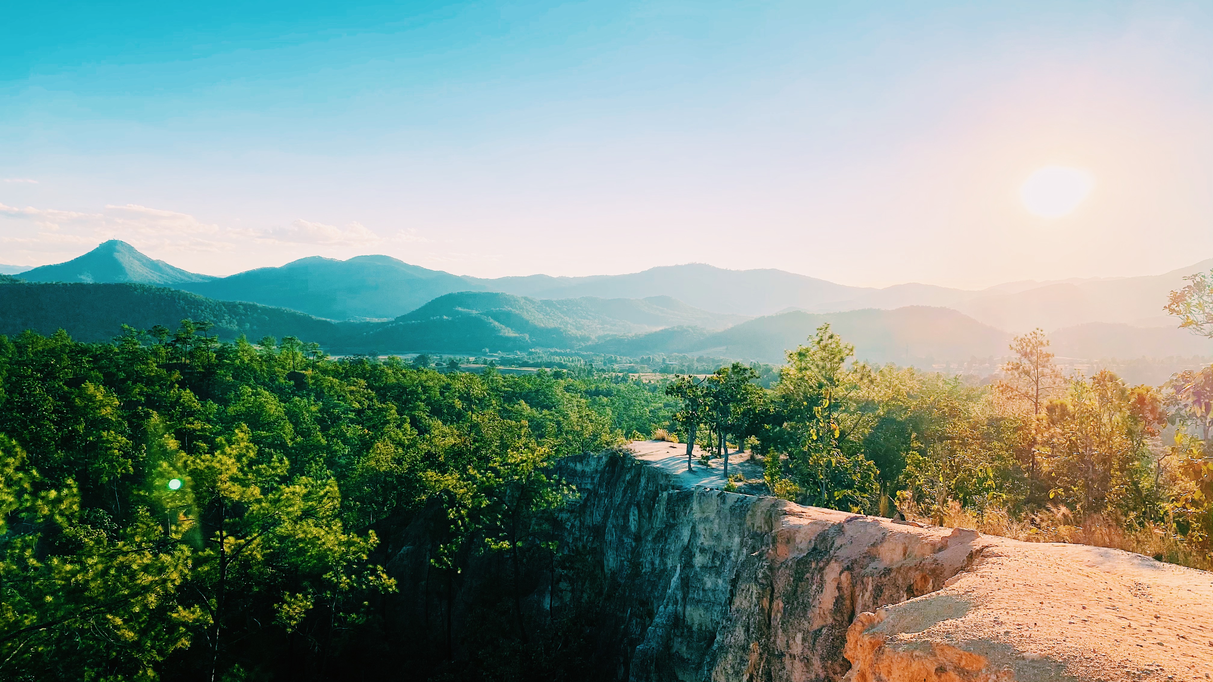
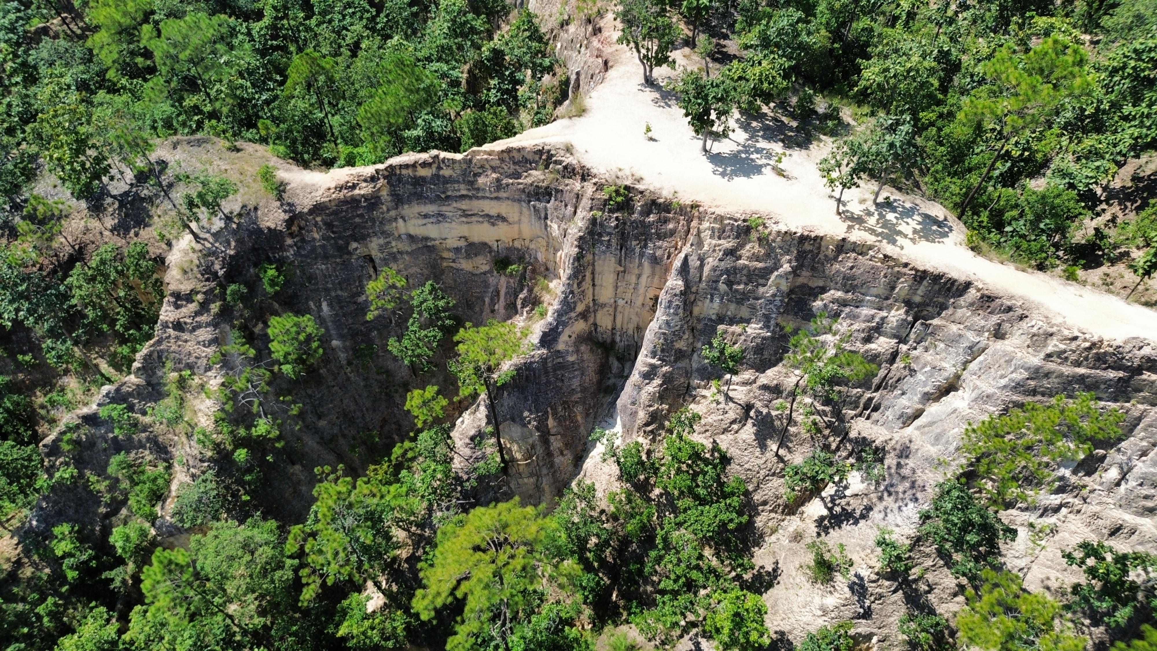
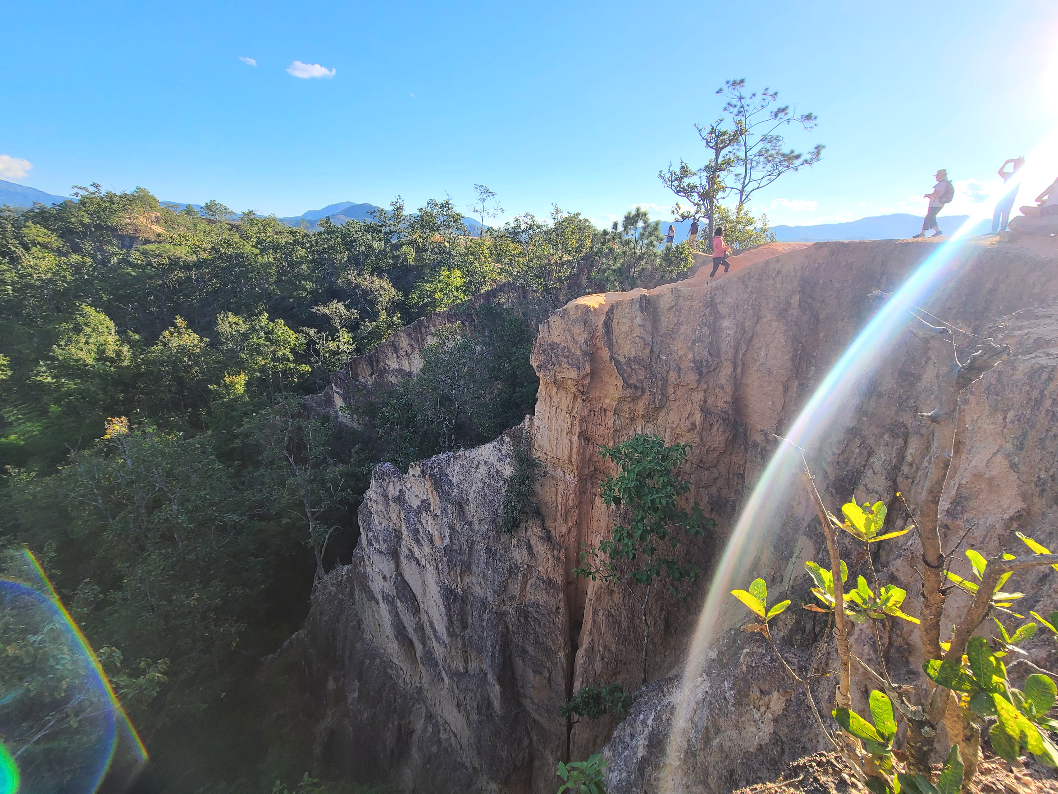
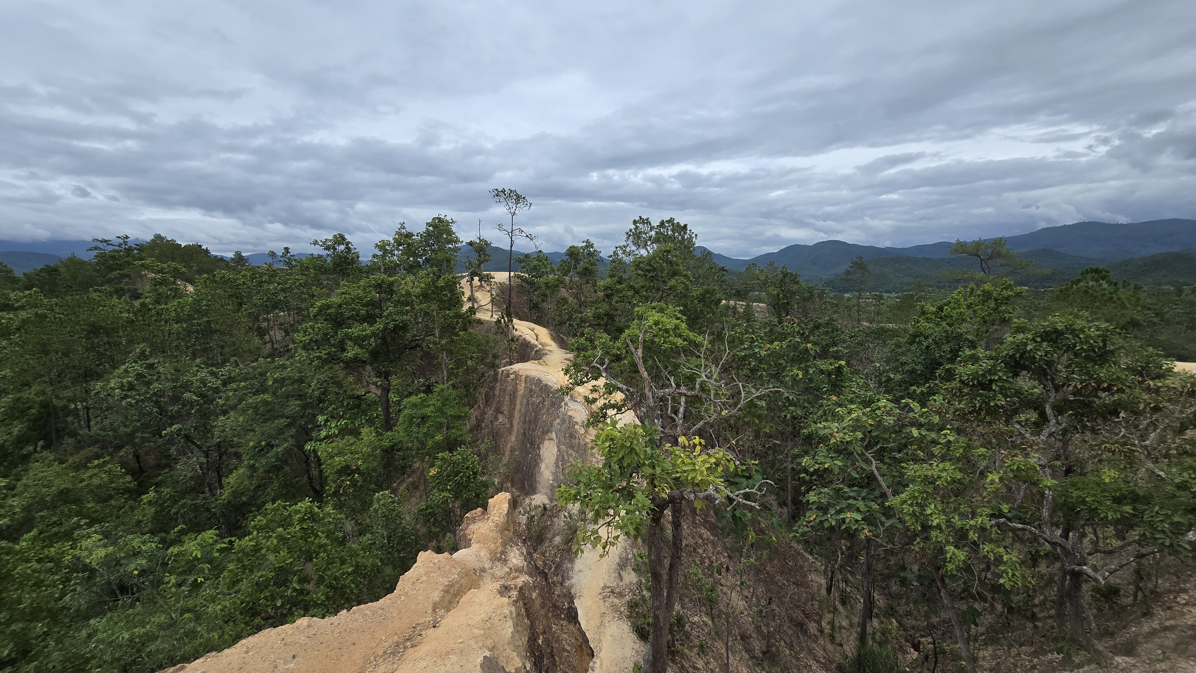
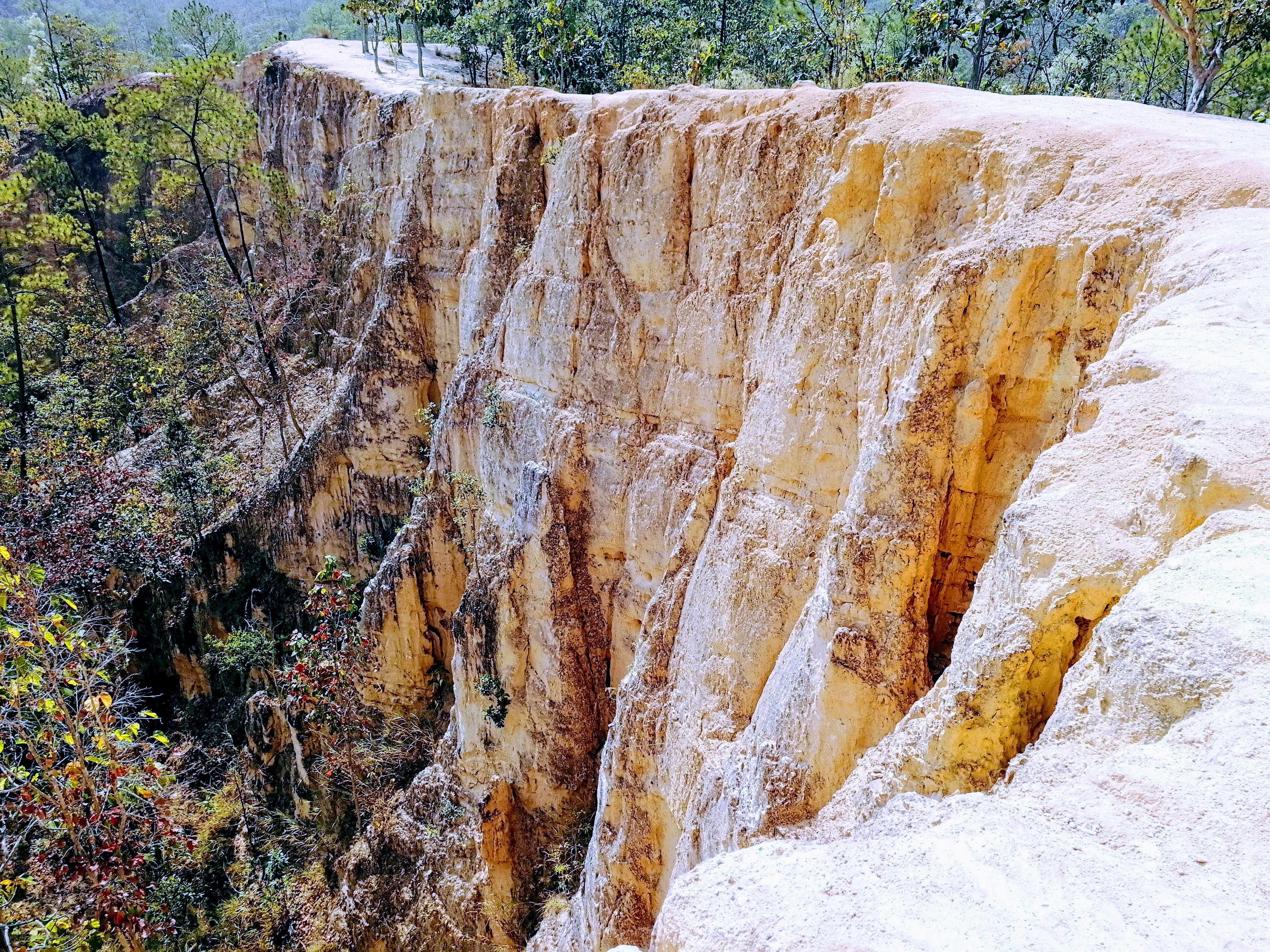
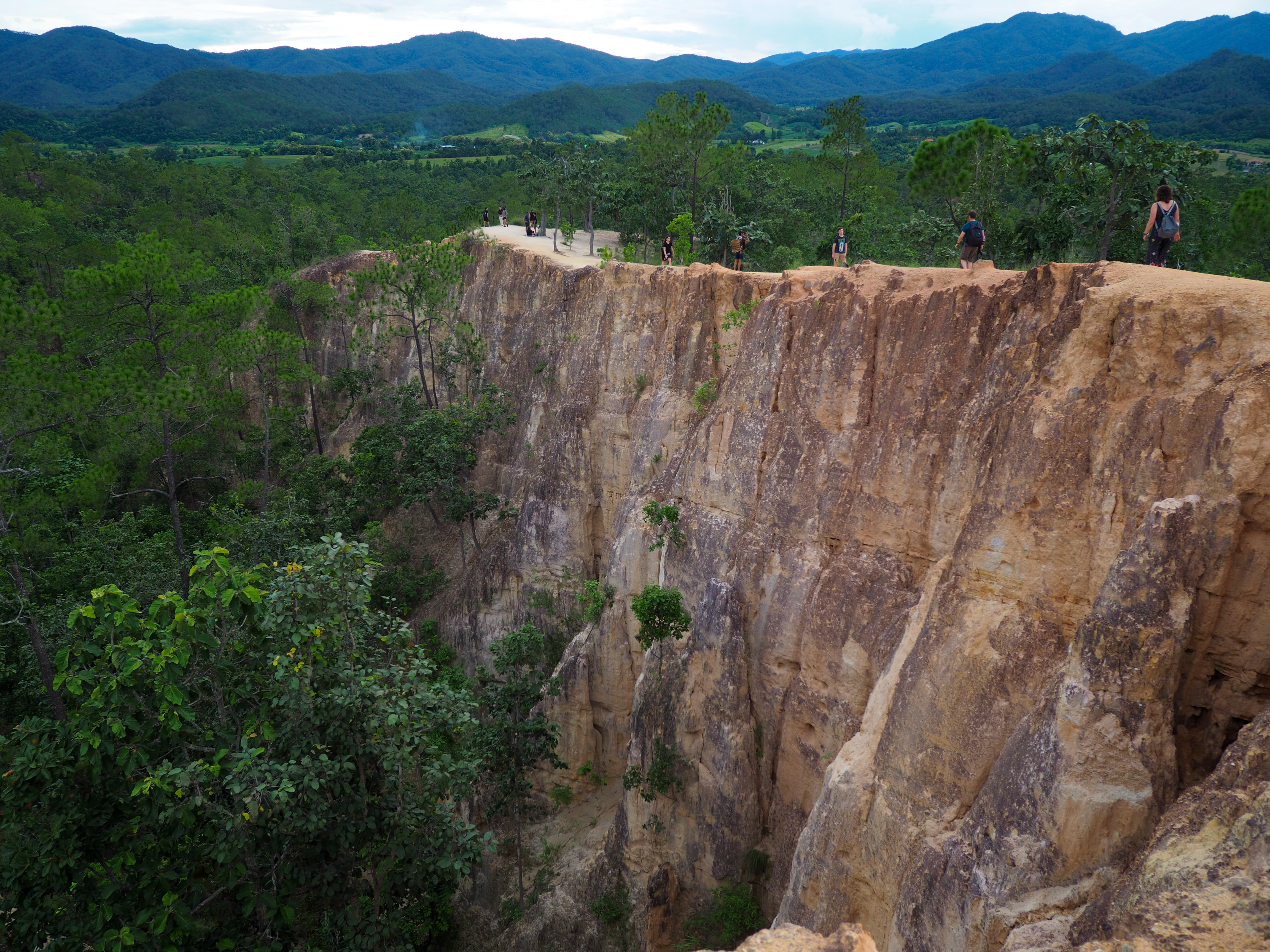
Pai Canyon - main view of the red-earth ridges in Pai, Mae Hong Son, Thailand

Viewpoint · Pai, Mae Hong Son · Northern Thailand

Pai Canyon (Pai)

Pai Canyon · Pai, Mae Hong Son, Thailand

A free natural viewpoint of winding red-clay ridges, narrow trails and sweeping valley views — 8 km south of Pai town, famous for its copper sunsets.

★ 4.5 8,368 Google reviews Pai Canyon · Mae Hong Son

Rating and review count synced from Google Maps (Google Maps) user reviews · September 2026 · View all reviews on Google Maps ↗

View location on Google Maps

Mae Hong Son · Northern Thailand

Pai Canyon

PAI CANYON

Today's Weather & Light Windows Live Weather
🌦️ Live weather at Pai Canyon
28°
Warm / clear
💨 5 km/h
☀️ Today's sunset index

Clear · ~85% chance of golden light

Today's Weather & Light Windows

Live weather at Pai Canyon

Golden Hour06:00 – 07:30
Sunset18:30
Blue Hour18:50 – 19:20
Travel TipGo at sunrise or sunset — midday heat is intense and the light is flat

Times computed from Pai Canyon's real coordinates

About

About Pai Canyon — Northern Thailand's Red-Earth Ridgeline

Welcome to Pai Canyon (ปายแคนยอน, locally known as Kong Lan), widely recognised as the red-earth canyon viewpoint of Northern Thailand. Located in the heart of Pai, Mae Hong Son, Thailand, this destination serves as a primary hub for travelers visiting the region.

A free, open-air viewpoint of winding red-clay ridges, narrow trails and sweeping valley views, about 8 km south of Pai town.

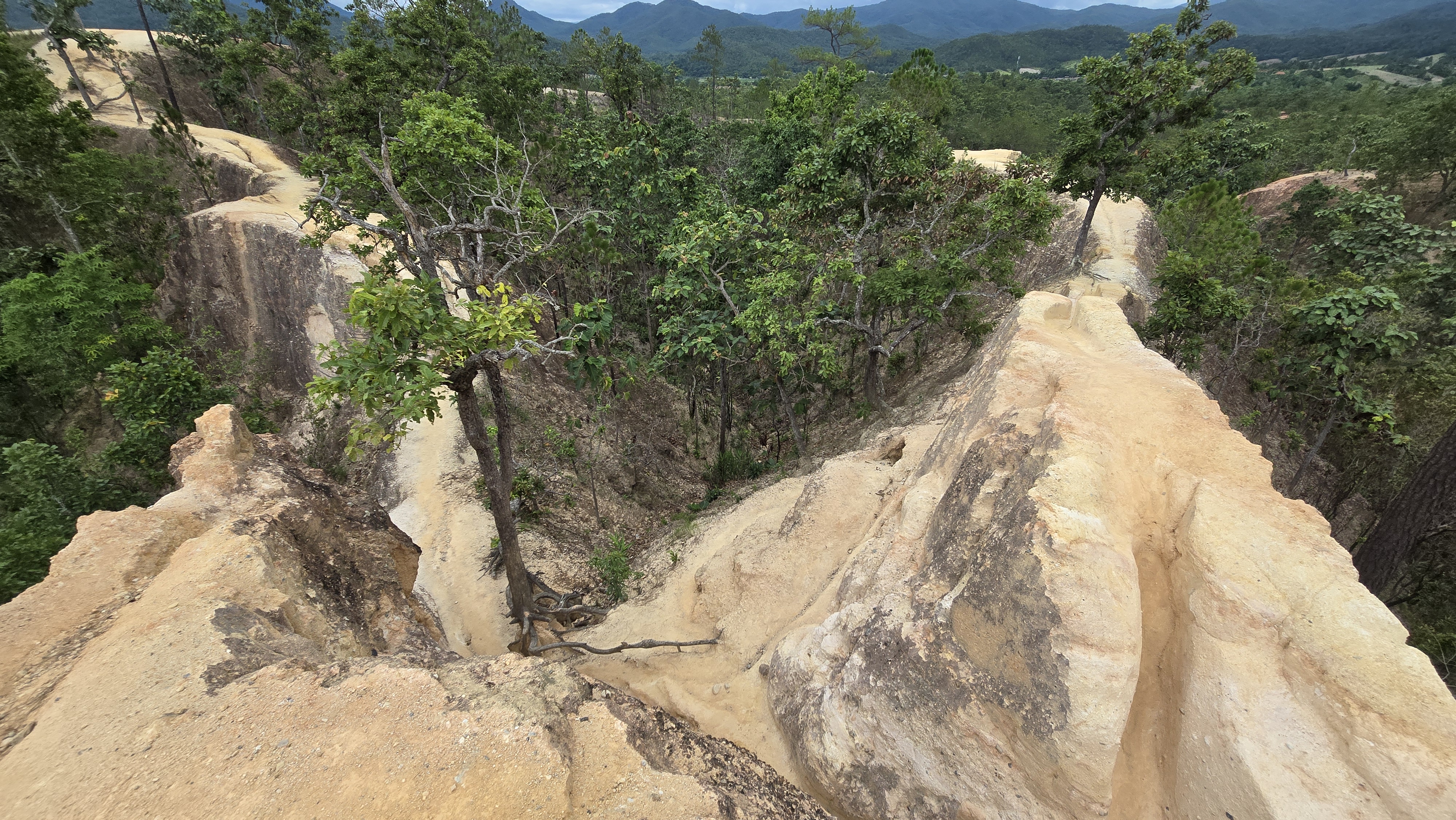
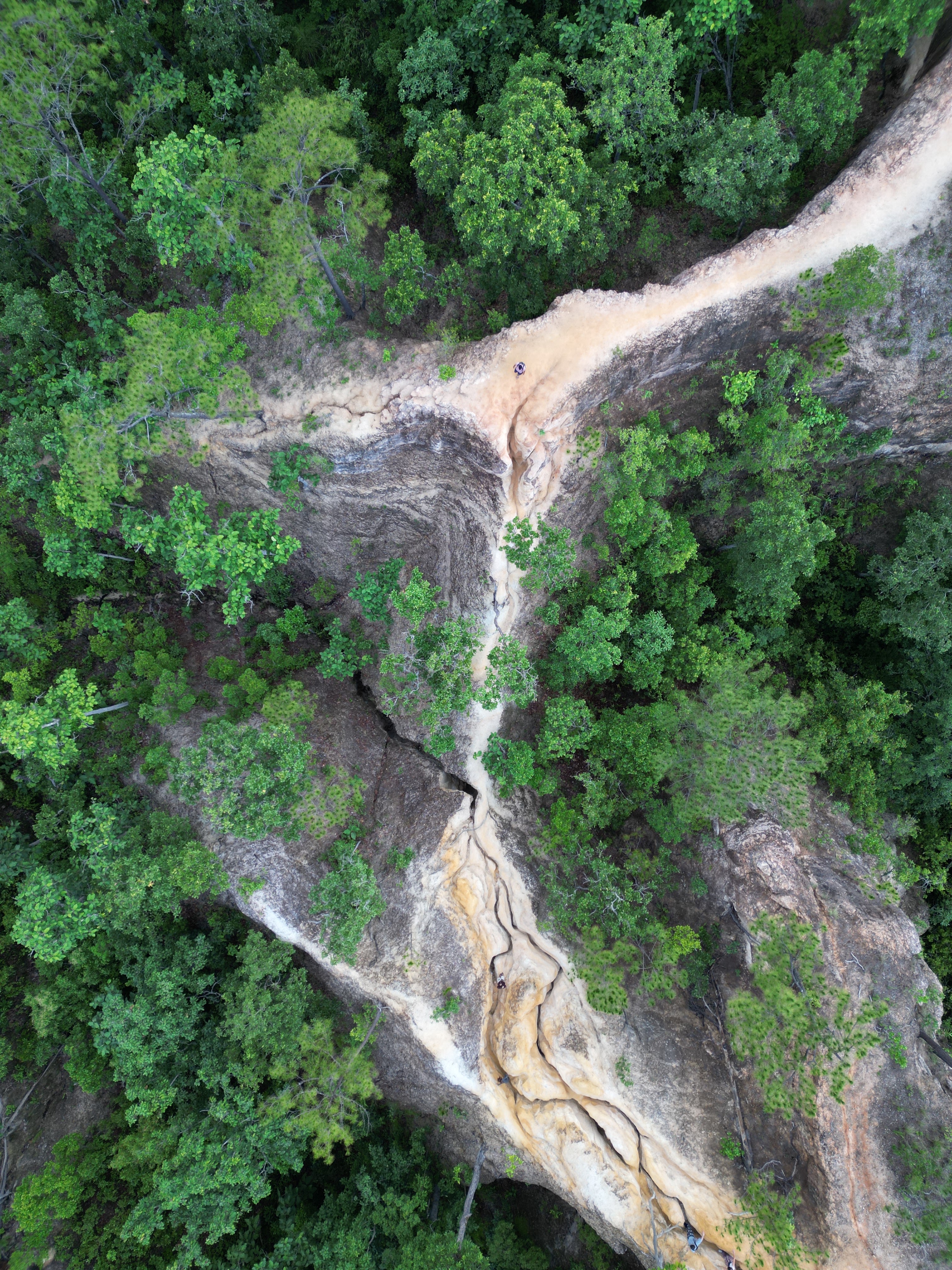
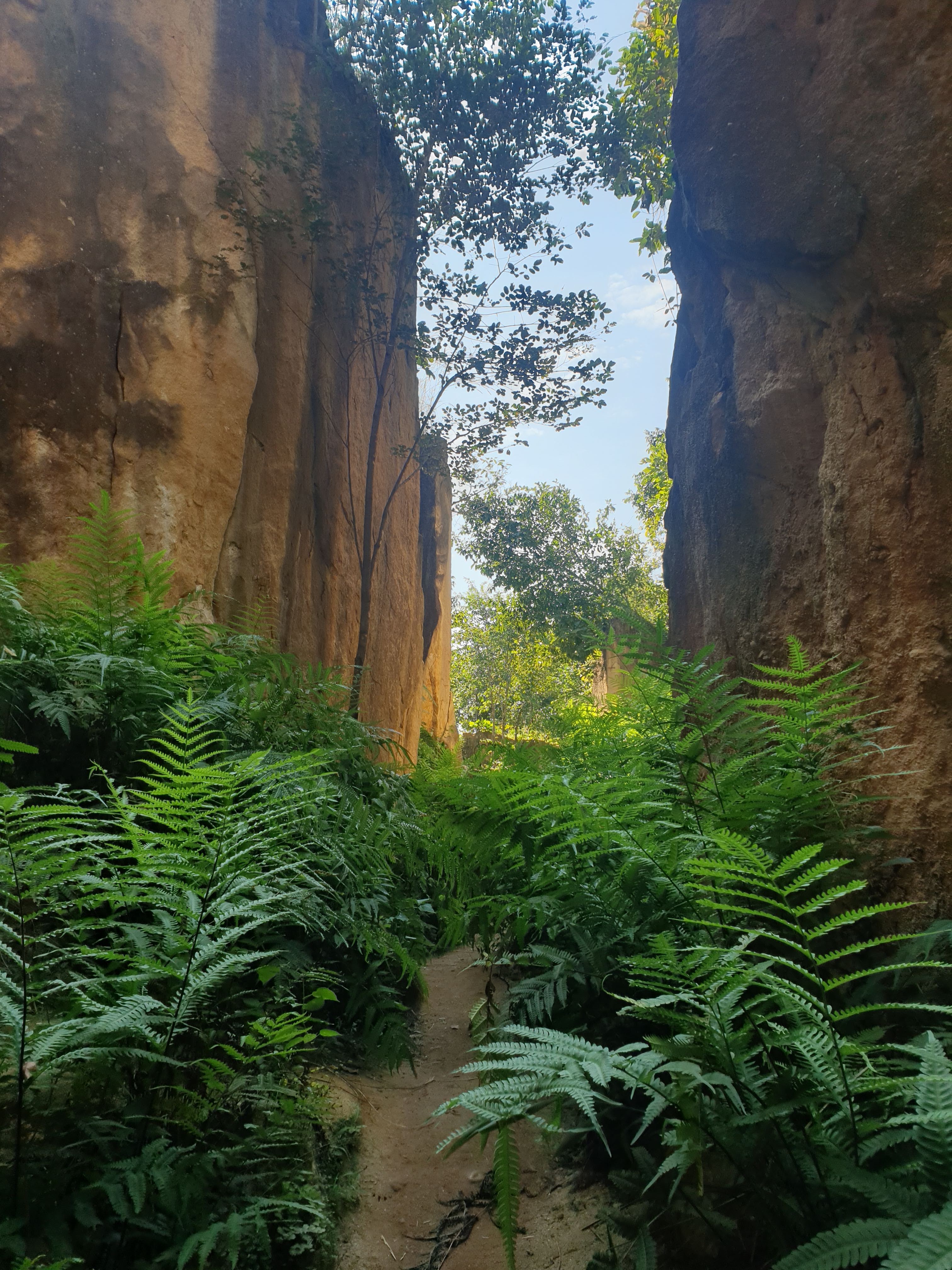
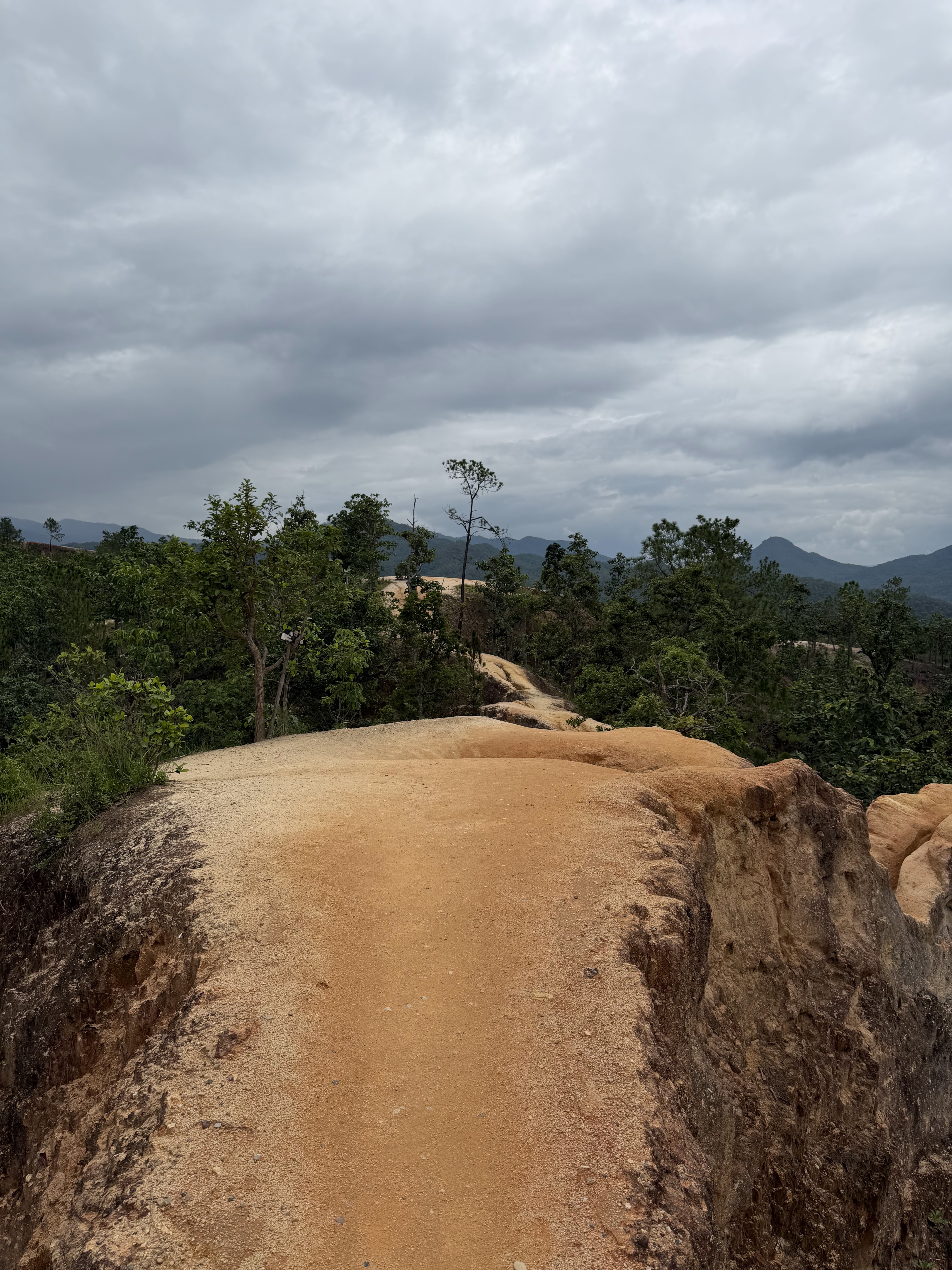
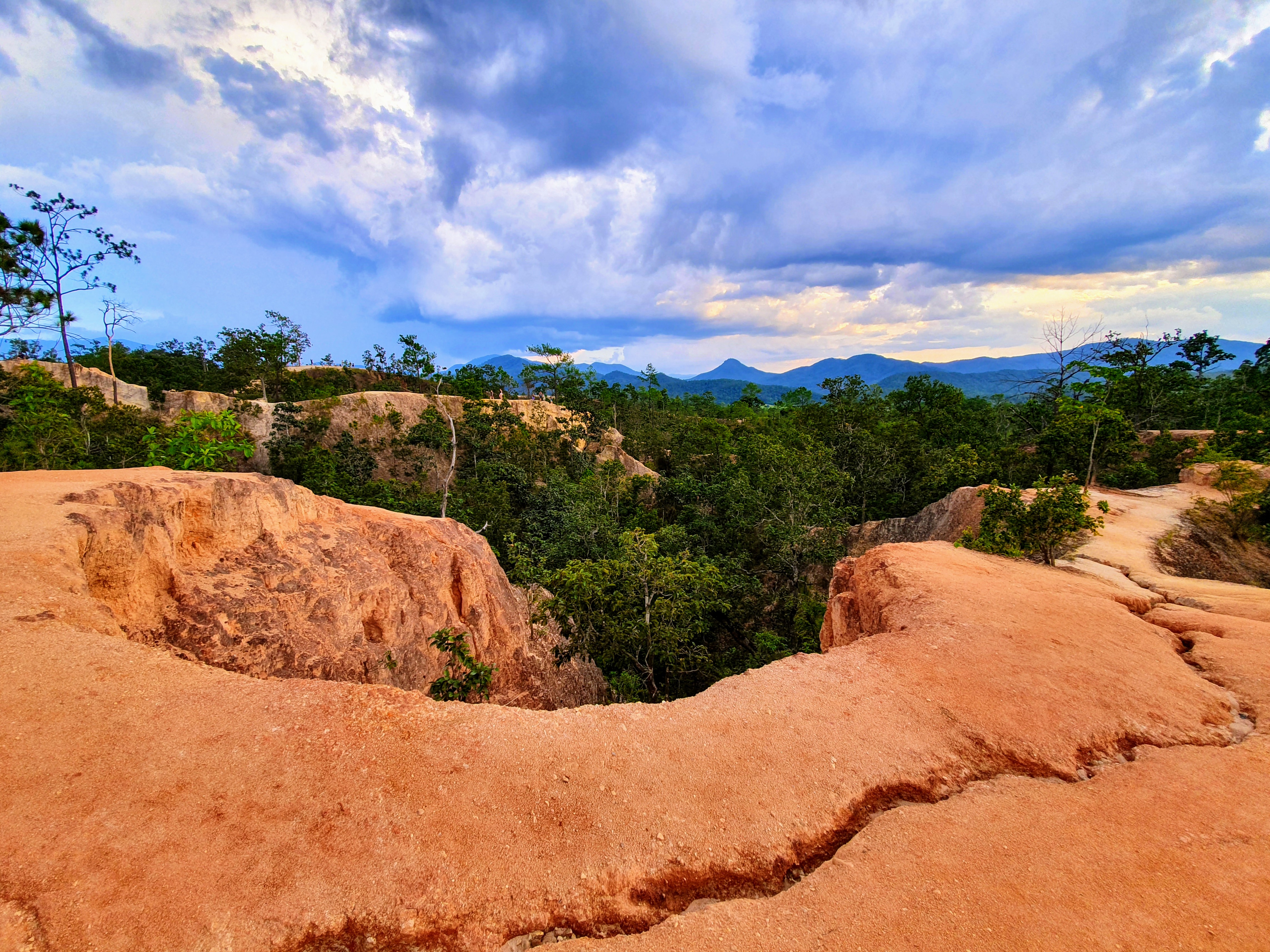
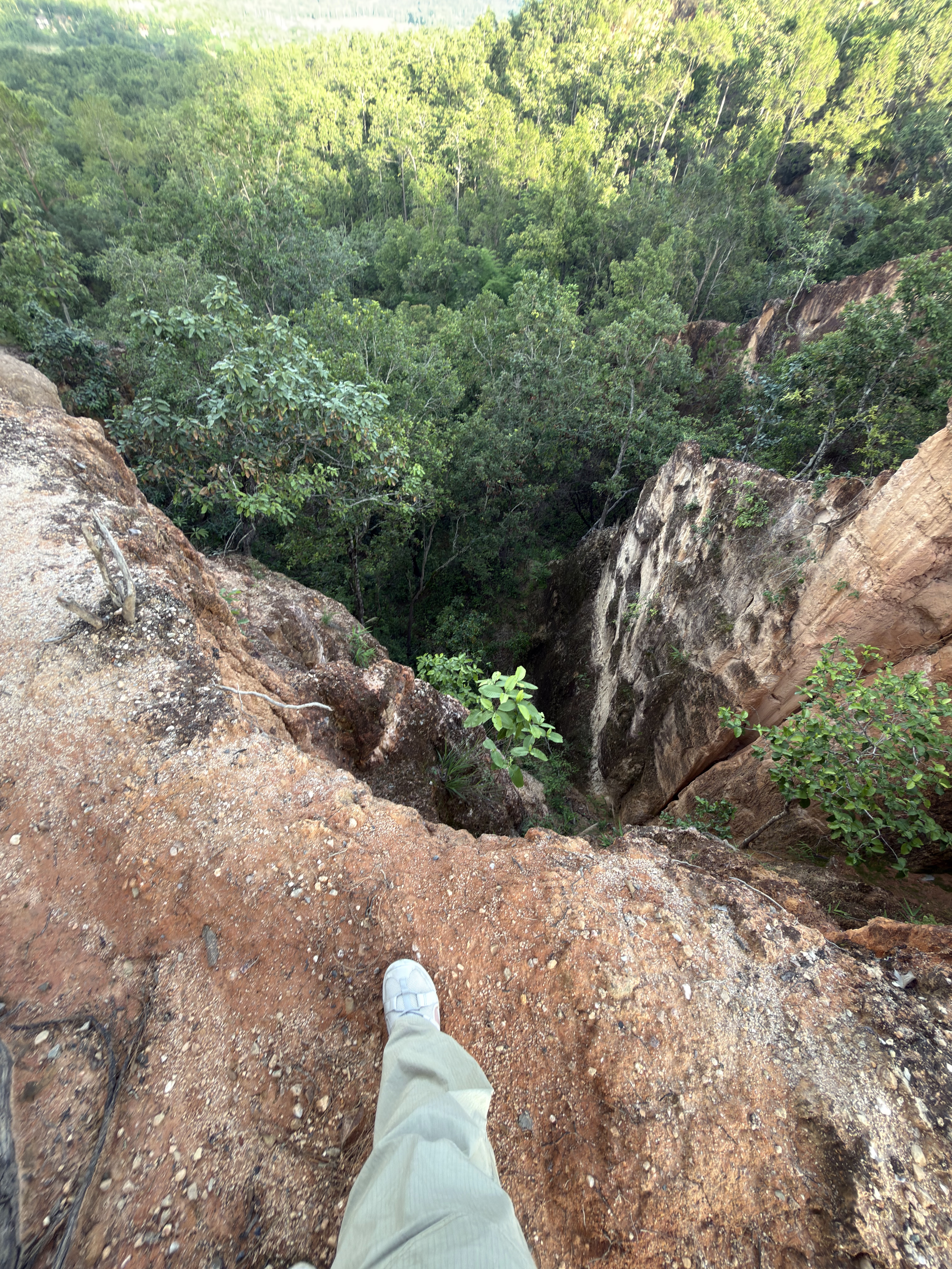
Pai Canyon (also called Kong Lan, กองหลาน, in Northern Thai) is a natural landform carved by rain and wind into a maze of narrow red-laterite ridges and steep gullies. Unlike a fenced viewpoint, the trail follows the very edge of the cliffs — a short but thrilling walk with drop-offs on both sides. Entry is free and it is one of the most photographed spots around Pai.

The canyon sits on the hills between Pai town and the Mae Hong Son highlands. At dawn and dusk the laterite walls glow copper-red and the whole valley falls quiet, which is why visitors from all over the world time their trip to the light. Wooden ladders and a few metal rails help on the steepest sections, but much of the path is raw earth.

When visiting Pai Canyon, visitors can easily explore surrounding landmarks and points of interest, including Pai Town (Walking Street) and Tha Pai Hot Spring.

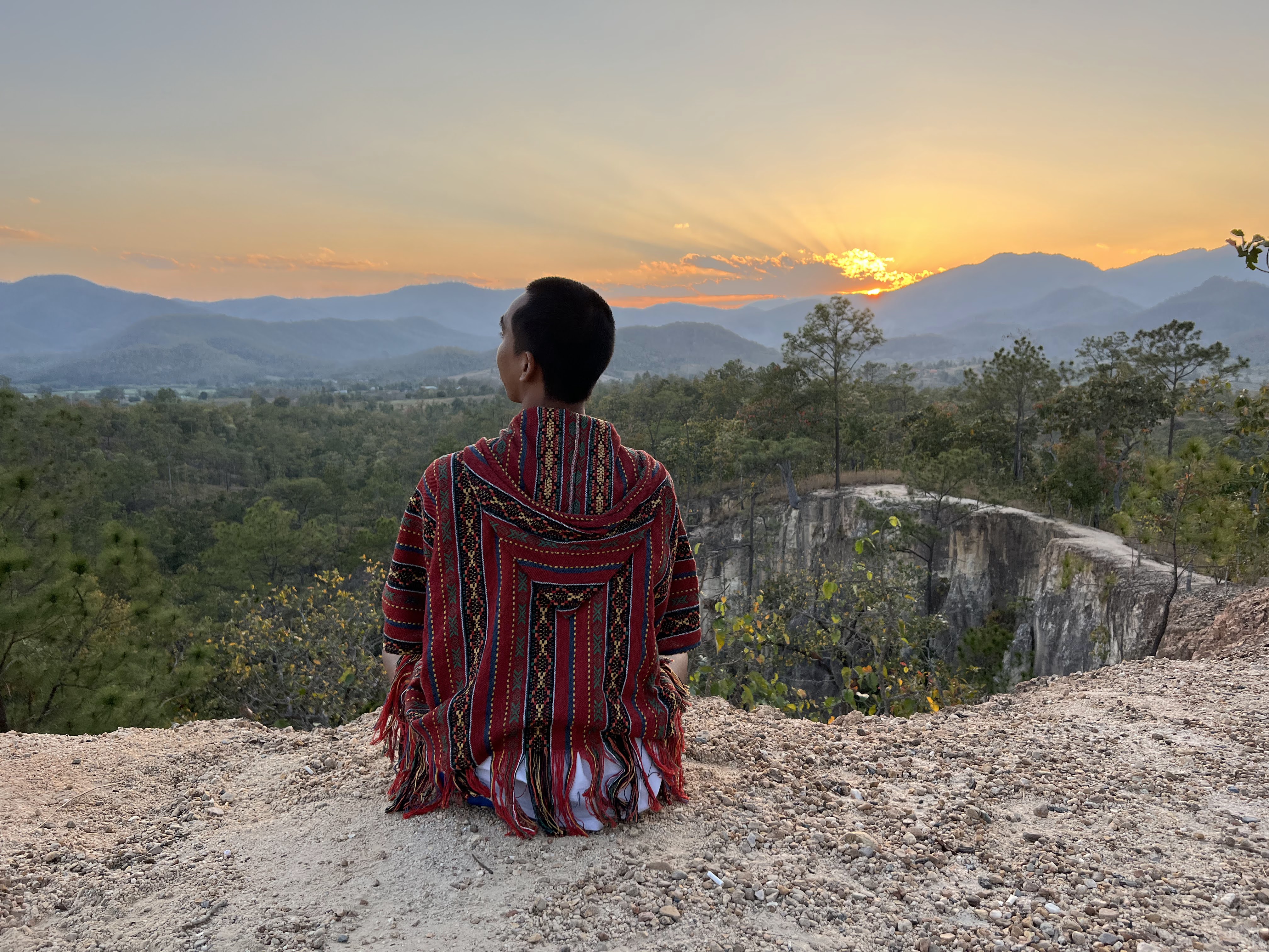
“Stand at the edge at sunset and the whole valley turns to copper.”
— — A Pai local
~8 km
from Pai town
4.5
rating
Free
no entry fee
Canyon
Red-earth ridges
Wind-carved laterite walls and gullies form a natural maze above the valley
Sunset
Golden-hour viewpoint
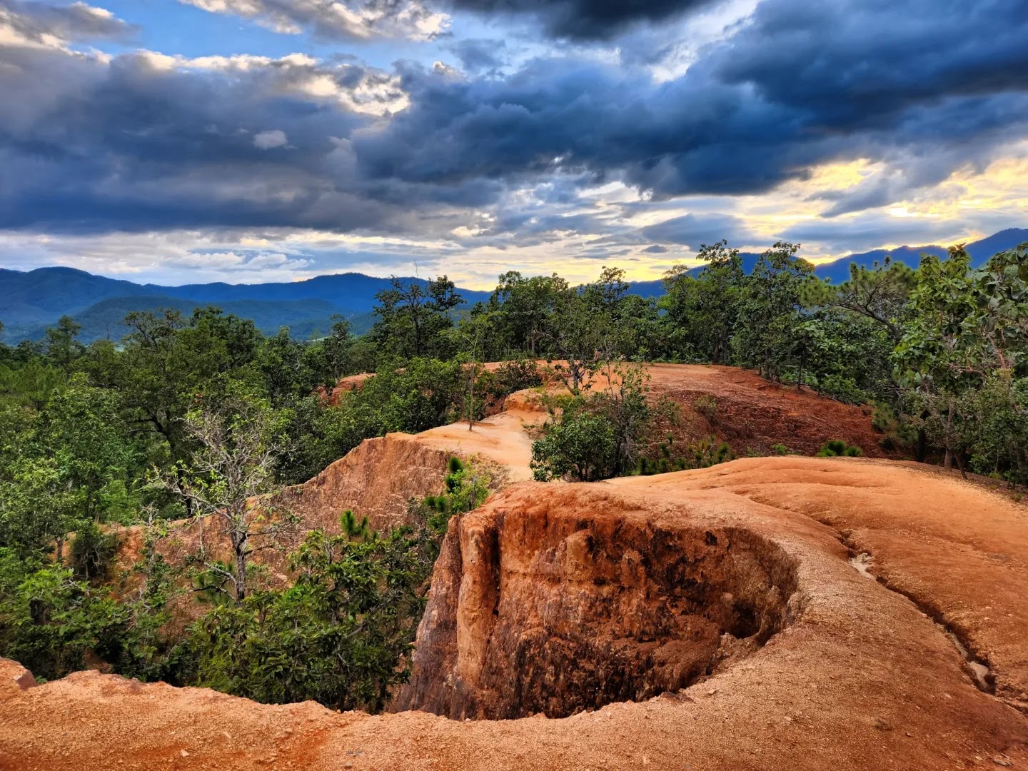
The rim lights up copper-red at dawn and dusk — Pai's classic photo spot
Trail
Easy yet thrilling
A short ridge walk with ladders and rails, but steep, open drops on both sides
Editor's Tip

Spend at least one sunset here — arrive 45 minutes early to claim a ridge spot and watch the light move across the gullies

See the map →

Landscape

Red-Earth Canyon & Forest Edge

“Few places pack so much drama into a ten-minute walk — from cracked laterite to forest birdsong in one breath”

Pai Canyon is a meeting point of two worlds: the bare red laterite of the eroded ridges and the green forest that still clings to the valley floor. Understanding the land helps you walk it safely and tread lightly.

1. How the canyon was made

Laterite soil

The reddish earth is laterite, rich in iron and aluminium oxides. Baked by the sun it 'ferricretes' and sets almost as hard as concrete, yet grows fragile with moisture — which is why the ridges feel rock-solid in the dry season but soap-slick in the rains, and why they are cut so sharply

Wind & rain erosion

Centuries of monsoon rain and wind carved the soft earth into a maze of narrow fins and gullies

A living edge

The rim keeps changing after each storm — a section that was wide last year may be a thin ledge today, so never assume the path is fixed

2. Plants that hold the ground

Grasses & ferns on the rim

Tough wild grasses and ferns root into the cracks and slow the erosion — the only thing keeping the narrow ridges from washing away

  • Dry-season hardpan — In the hot season the surface bakes solid and is firm underfoot; after rain it turns to slick clay
  • Dry dipterocarp forest (valley floor) — Below the rim grows Northern Thailand's mixed deciduous and dry dipterocarp forest. These trees shed their leaves seasonally to survive the parched red soil, shading the gullies and sheltering birds
Trees at the viewpoints

Scattered shrubs and small trees mark the safer, wider sections where visitors gather for photos

  • Shade at the entrance — A few trees near the parking give the only real shade — rest here before the open ridge
  • Roots as handholds — Tree roots double as natural rails on the steeper drops
Seasonal wildflowers

After the first rains small wildflowers speckle the red earth, a brief contrast against the laterite

3. Wildlife along the rim

  • Reptiles: Bengal monitor lizards warm themselves on the rocks; geckos and skinks dart across the path
  • Birds: bulbuls, tailor birds, sunbirds and the occasional raptor ride the valley thermals above the canyon
  • Insects: butterflies and dragonflies gather in the gully breezes, especially in the wet season

4. Tread lightly: Leave No Trace

This is an open, unfenced natural site — small actions keep the ridge safe and beautiful for the next visitor

✔ Tick these off before and after your walk — a small courtesy for the next visitor

🌿 Flora & Fauna checklist

Bring this checklist to Pai Canyon and log what you spot along the rim:

Bengal monitor lizard

🗓 Year-round · basks on warm rocks mid-morning

Rarity: ★★

Red-whiskered bulbul & tailor birds

🗓 Year-round · most active at dawn and dusk

Rarity: ★★★

Butterflies & dragonflies

🗓 Mar–Oct · swarm the gully breezes

Rarity: ★★

Wild grasses & ferns

🗓 Greenest in the wet season · roots hold the fragile soil

Note: ★

History

History & Significance of Pai Canyon

From ancient Shan valleys to a backpacker landmark — the land, the town and the name

01

Millions of years — Earth shaped the ridges

The red laterite of Pai Canyon was laid down and then slowly sculpted by monsoon rain and wind into the narrow fins and gullies we walk today. Unlike limestone karst, this is soft earth — the canyon is constantly reshaped, a little, after every storm.

02

Older days — Muleteer caravans & the tea-horse trails

Long before Route 1095 was paved, this area lay on the caravan routes linking Chiang Mai, Pai and Myanmar's Shan State. The red-clay ridges were a striking natural landmark — old trading caravans used them to know they had reached the southern gateway into the Pai basin.

03

The 1940s — Pai, a Shan-Burmese border town

Pai sits in a broad valley near the Myanmar border, long home to Tai Yai (Shan) and Karen communities. Its name is often traced to the Tai Yai word for the local river. During World War II the Japanese army built the now-famous Memorial Bridge (Saphan Watanan) across the Pai River as a supply line — today a beloved photo stop.

04

1990s–2000s — Pai's backpacker boom

After the road from Chiang Mai improved, Pai blossomed into a laid-back haven for travelers, artists and yogis. Its relaxed vibe and surrounding nature — hot springs, waterfalls and this red canyon — turned it into one of Northern Thailand's most talked-about small towns.

05

Today — A free community viewpoint

Pai Canyon (Kong Lan) is now a free, community-managed viewpoint. No ticket booth, just a small parking area, a few rails and ladders, and one of the best sunset seats in Mae Hong Son.

📜 The name: from 'Kong Lan' to 'Pai Canyon'

Locals call it Kong Lan (กองหลาน) — in Northern Thai 'kong' refers to a winding earth gully or ravine and 'lan' to its many branching arms, a fitting name for this maze of red fins. Travelers later nicknamed it 'Pai Canyon', and the name stuck. Some also call it 'Thailand's little Grand Canyon', though that title is more often given to Sam Pan Bok on the Mekong.

Did you know?

Pai Canyon is free and open every day, and its red laterite glows copper at sunset. Because the earth is soft, the exact shape of the ridges shifts slightly year to year — no two visits look quite the same.

📖 Folk legend: the hunter, his grandson and the maze

In old Tai Yai (Shan) stories, 'Kong Lan' (กองหลาน) means more than 'winding gully' — elders also called it the 'labyrinth valley'. Legend tells of an old hunter who followed a sacred white deer with his grandson (Lan) and lost his way in this maze of red-clay cliffs. Locals still use the tale as a warning: the ridges are steep and shift like a maze — never wander in carelessly.

The little shrine by the trail

The small shrine at the foot of the ridge honours the local guardian spirit (Chao Pho). By Northern Thai custom, passing caravans and hunters would light incense here before the steep ridge, asking the mountain spirit for protection against a fatal slip.

How Pai Canyon Became a Destination

The ridge itself has no recorded building history — its story is one of geology, land use and the road that opened the Pai valley to the outside world.

  1. Pre-1970s

    Pai district is a remote farming valley in Mae Hong Son, reached from Chiang Mai by a long, slow mountain route. The canyon is simply grazing and scrub land above the Mae Hi valley.

  2. 1970s

    Route 1095 is built and sealed over the mountains. The road is famously winding — local markers still count 762 curves between Mae Malai and Pai — and with it, the first casual visitors reach the district.

  3. 1980s – 1990s

    Pai becomes a stop on the northern backpacker circuit. The ridges start to appear in guidebooks as a free, unmanaged viewpoint on the road south.

  4. 2000s

    Domestic tourism grows quickly, and the sunset viewpoint becomes a known Thai photo stop as much as a foreign one. Basic stalls and a parking area appear at the entrance.

  5. 2010s

    Photography and social media turn the narrow fins into one of the most reproduced landscapes in Thailand. Visitor numbers at sunset rise sharply and crowd management becomes an issue.

  6. Today

    The site remains a free, open natural area with no formal visitor centre, no lighting and no barriers beyond short sections of chain. Management is light and pressure on the edges is real.

Stories, Names & Local Lore

Collected from local usage and public sources, and marked so you can tell documented history from the stories people simply tell.

Local name Documented usage

Why Mae Hi residents say Kong Lan

Long before "Pai Canyon" appeared on English-language maps and road signs, the ridges above the Mae Hi valley carried a local name still in use by older residents: Kong Lan. It is a reminder that the site was a familiar piece of farmland and forest long before it became a photograph.

The road Documented history

The 762 curves that opened the valley

Pai was effectively sealed off until Route 1095 was driven over the mountains. Its thousand-plus bends — the celebrated count between Mae Malai and Pai is 762 — made the canyon a natural roadside stop, and it is still how most visitors first see it. The same curves are why an 8 km drive can take twenty minutes.

Ancient ground Local understanding

Land that erodes and returns

In local telling, the red earth is not permanent; it is being given back to the valley a little at a time. That matches the geology — the fins are the remains of a surface being removed from both sides — and it is the reason older farmers treat the slopes as land in transit rather than a fixed landmark.

Culture Documented history

A valley of many communities

Mae Hi and the villages around the canyon are home to Shan, Karen, Lisu, Lahu and Yunnanese communities alongside northern Thai families. The canyon is a natural feature of an inhabited farming landscape, and the fields, irrigation channels and smallholdings around it are as much part of the visit as the viewpoint itself.

Sunset Recent lore

The copper hour

The claim that the whole valley turns copper at dusk is repeated by almost everyone who comes down from the ridge, and it is the reason the car park fills in the last hour of daylight. It happens when low sun, dry-season haze and the red laterite line up — which is exactly why it is not guaranteed.

Did you know? The canyon is a comparatively young landform. Because the laterite is soft and rainfall in the Pai valley is heavy, the ridge loses material every monsoon season: the fins are being carved, narrowed and occasionally undermined in real time.

Science

The Science Behind the Red Ridges

Pai Canyon is not a canyon in the river-cut sense: it is a ridge of soft, iron-rich laterite that rain has sliced into narrow fins. Understanding how it formed explains why it changes shape, and why it demands care.

01

Why the ground is red

The ridges are built from laterite — a soil and soft rock horizon that forms when intense tropical rainfall leaches silica and soluble minerals out of the ground and leaves iron and aluminium oxides behind. Those oxides are what give the surface its rust-orange colour, and they also cement the sediment into a material that can stand as a near-vertical fin before it finally collapses.

02

Layers that were lifted and tilted

The laterite sits on a sequence of sedimentary beds — sandstones, shales and thin limestone — laid down long ago and then raised by the tectonic forces that built the highlands of northern Thailand. Walking the ridge, you are effectively walking along an eroded edge of that uplifted block, which is why the valley falls away on both sides at once.

03

Rain does the carving

Each monsoon season, water running off the ridge gathers into rills, then gullies, then deep channels. The strips of ground left standing between two channels narrow into the knife-edge partitions the site is famous for. This is why the canyon is genuinely young and genuinely mobile: every wet season removes material, and the fins you photograph this year are not exactly the fins of a decade ago.

04

A habitat on difficult ground

Laterite is acidic, nutrient-poor and dries out completely between showers, so the plant cover is sparse and tough: grasses, scrub, fire-adapted trees and low pine. The open habitat suits lizards, snakes, insects and hunting birds such as kestrels and bee-eaters, while the surrounding valleys of Mae Hi subdistrict are farmland — rice, corn and smallholdings — rather than forest. The ecosystem here is a product of poor soil and a hard dry season, not of lush rainforest.

Visitor Responsibility

Pai Canyon is an unprotected natural surface with no barriers, no lighting and no rescue patrol. Almost all of the damage and almost all of the accidents here come down to a handful of habits.

  • Stay on worn paths and keep to the wide, stable parts of the ridge.
  • Wear shoes with real grip — trainers or hiking shoes, not sandals or flip-flops.
  • Carry at least one litre of drinking water per person and a hat.
  • Tell someone where you are going if you plan to walk the full ridge alone.
  • Take every piece of litter back to the entrance bins, including fruit peel.
  • Keep a head torch or phone light for the walk back after sunset.
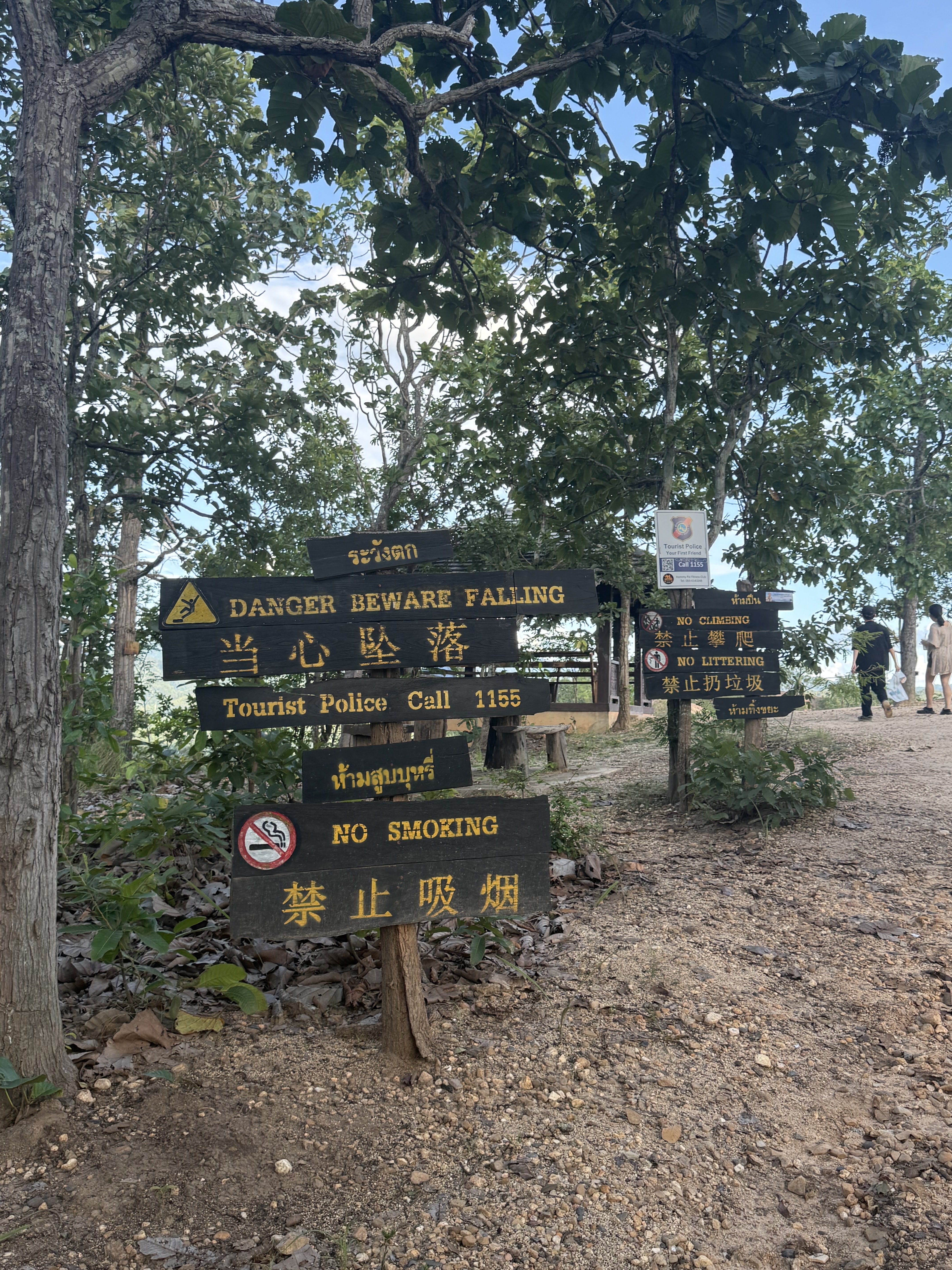
  • Do not step over or around any safety chain, rope or warning sign.
  • Do not walk the narrow outer fins, especially in wind or after rain.
  • Do not climb the fins for a photo, and do not sit on unsupported edges.
  • Do not light fires, incense or sky lanterns on the ridge.
  • Do not fly drones over the crowded sunset viewpoints.
  • Do not enter restricted or fenced-off vegetation on the surrounding farmland.

Staying safe on the ridges

Slippery after rain

Wet laterite behaves like grease. If it rains, wait for the surface to dry or stay on the fenced platform.

Wind gusts

The ridge funnels gusts that can unbalance an adult on a narrow fin. Crouch and move on hands if you are caught out.

Heat and dehydration

There is no shade and no water on the ridge. Heat exhaustion is the most common problem reported here.

Crevasse-like gullies

The gaps between fins can be deep and hidden by grass. Never jump across them and never descend into one.

Darkness

The site is unlit. If you stay for the sunset, finish your walk before the last light goes.

Seasons

Season-by-Season Visiting Strategy

Pai sits in a monsoon valley, so the year splits into four clearly different windows for the canyon. The table below summarises typical weather, the best visiting strategy, the quality of light, crowd levels and an overall rating for each one.

Season Months Typical weather Visiting strategy Light & photography Crowds Overall
Cool dry season Nov – Feb Clear, dry and cool. Mornings 12–18 °C, afternoons 24–30 °C; clear nights on the ridge can fall below 10 °C. The best all-round window. Walk the full ridge mid-morning or in the two hours before sunset; bring a light layer for the evening. Long, clean golden hour, low haze and sharp valley silhouettes — the most reliable sunset photography of the year. Busiest, especially late December to mid-January and around Thai New Year holidays. Arrive 45–60 minutes before sunset. ★★★★★
Hot dry season Mar – Apr Peak heat: 33–38 °C by midday, almost cloudless, dust and smoke haze build through late March and April. Walk at first light (06:00–09:00) or after 16:00. Shorten the route, take more water than feels necessary and avoid the exposed middle section at midday. Very strong contrast after 10:00, which flattens colour; the haze can turn sunsets a heavy orange or mute them completely. Generally quiet, except Songkran (13–15 April), when Pai district fills up for several days. ★★★☆☆
Green season May – Jun The first monsoon showers arrive as short, heavy afternoon storms. Green-up happens fast; humidity climbs and the air clears. Use the dry mornings and treat the ridge as a morning activity. Check the radar before setting off and expect slippery laterite for a day after rain. Washed, dramatic cloud structures and occasional shafts of sun — good for atmospheric rather than classic sunset shots. Very light. This is the quietest good-value window of the year. ★★★★☆
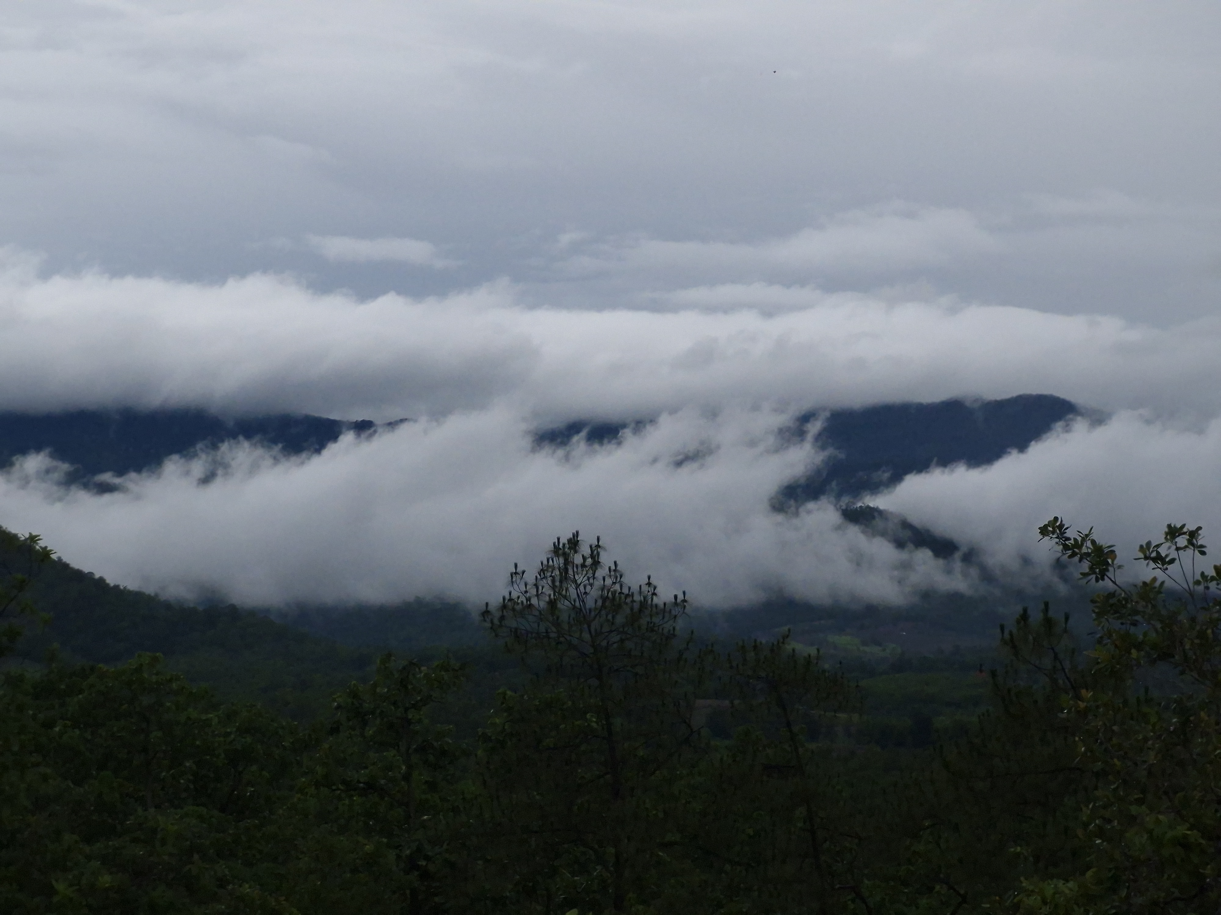
Rainy season Jul – Oct Frequent heavy showers, saturated soils and standing water in the gullies. Fog banks form in the valley on many mornings. Go in the reliable dry hours of mid-morning to early afternoon, stay on the main ridge, and skip the narrow outer fins entirely. Check access after storms. Moody fog and shafts of light between showers; a genuine dramatic sunset is possible but far from guaranteed. Lowest crowds of the year, with the biggest weather risk and the highest chance of a cancelled sunset. ★★★☆☆
  • Sunset time in Pai moves by roughly one hour across the year, so verify it on the day rather than relying on a fixed hour.
  • The burning-season smoke (mid-February to April) can reduce visibility substantially; plan a second morning if the view matters to you.
  • Rain can make the laterite footpaths dangerously slick — grip shoes are essential rather than optional in the wet months.

Typical conditions are drawn from the 1991–2020 climatological normal for Mae Hong Son Province and from long-term records for the Pai valley. Individual years vary.

Routes

Recommended Routes for Every Kind of Visitor

Pai Canyon is small enough for a 45-minute stop and rich enough for a full day. Choose a plan by who is travelling with you and how much time you have, then adapt it on the ground.

Tailored plans by visitor type

Families with children

45 – 60 minutes

01

Families with younger children, grandparents and anyone who prefers solid ground underfoot.

  1. 1 Park in the lot beside the entrance and use the toilets there before setting off.
  2. 2 Walk the first wide lookout with the guard rails — this is the classic photo stop and it needs no scrambling.
  3. 3 Follow the main ridge only as far as the trail stays wide and level, then turn back at the first narrow section.
  4. 4 Finish with a cold drink at the entrance stalls while the light drops, then drive back to Pai town before dark.

Hold hands on the fins, keep children away from the outer edges and never let them run ahead on the ridge.

Photographers & nature lovers

2.5 – 3 hours

02

Anyone willing to walk the full ridge for the best light and the quietest angles.

  1. 1 Arrive 60–75 minutes before sunset and first scout the three main viewing points without a camera in hand.
  2. 2 Shoot the long views while the sun is still high enough to throw shape into the gullies.
  3. 3 Move to the far western viewpoint for the sunset itself — the light travels along the ridge line.
  4. 4 Stay for 20–40 minutes after the sun clears the horizon for blue-hour frames of the silhouetted fins.
  5. 5 Bring a head torch for the walk back to the car; the ridge is unlit.

A polarising filter cuts haze on the valley, and a tripod is worth the weight for blue hour. Watch for dust on the lens in the dry season.

Low-mobility and low-energy visitors

20 – 30 minutes

03

Visitors who use a stick or wheelchair, recover from injury, or simply want the view without the climbing.

  1. 1 Drive directly to the upper parking area beside the entrance to shorten the approach.
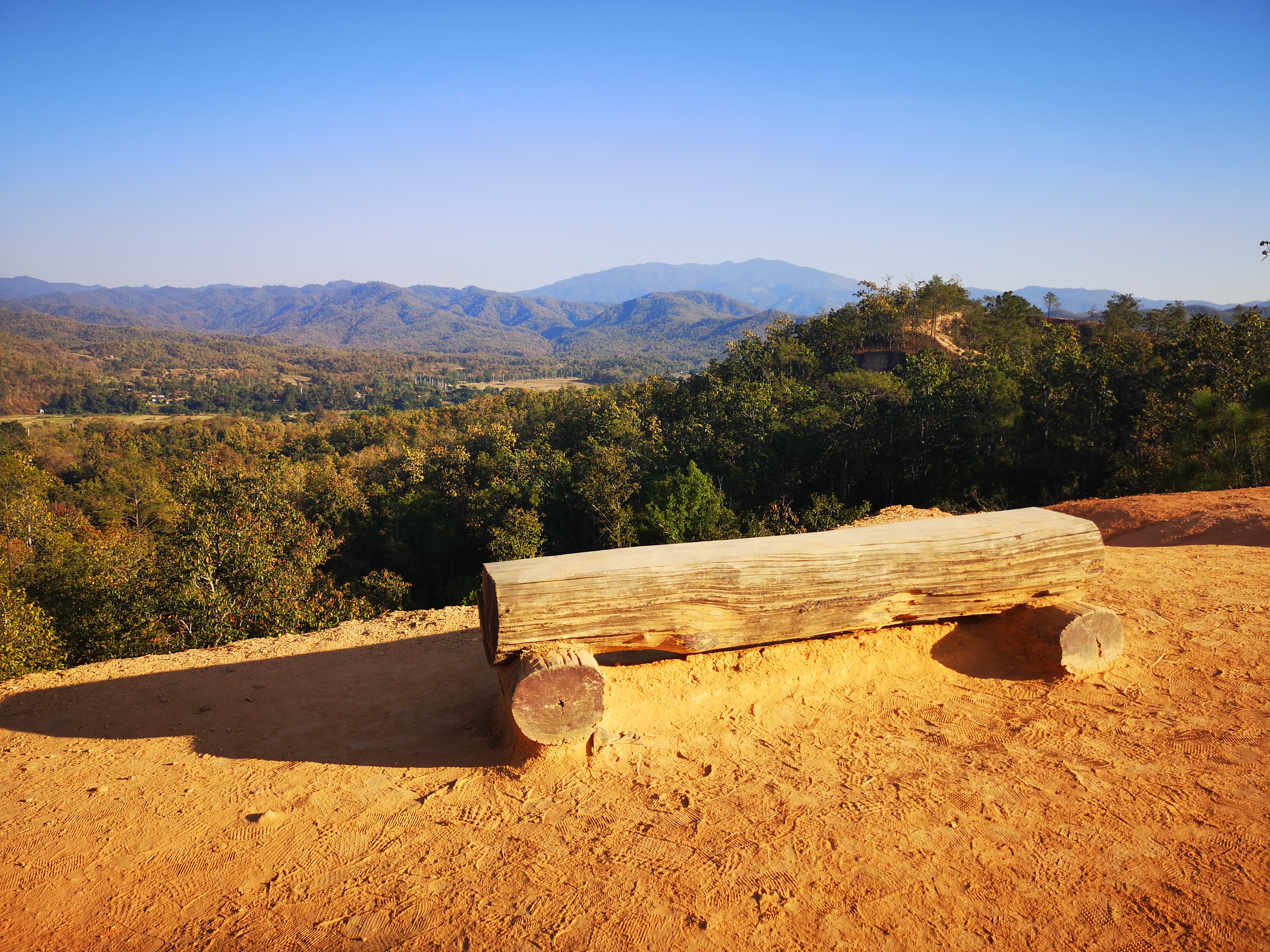
  2. 2 Stay on the flat, fenced viewpoint platform — it gives most of the classic panorama with no steps and no exposure.
  3. 3 Take the short graded path to the second bench if the surface is dry; skip it after rain.
  4. 4 Cool off in the shade by the stalls and watch the light change from the platform instead of the ridge.

The laterite is uneven and root-crossed off the platform, so wheelchairs should stay on the prepared surface. Avoid the narrow fins entirely.

Standard routes: half day and full day

Canyon & hot spring loop

Half day

3 – 4 hours

  1. 15:30 Leave Pai town

    Ride south on Route 1095, about 8 km of easy curves.

  2. 16:00 Walk the ridge

    45–60 minutes on the main ridge and viewpoints while the light softens.

  3. 17:15 Sunset from the west viewpoint

    The main event: the valley turns copper as the sun drops.

  4. 18:15 Tha Pai Hot Spring

    15 minutes further south for a soak before heading back.

Best in the cool dry season. Leave time for the drive back in the dark — the road has no street lighting.

South Pai countryside day

Full day

7 – 8 hours

  1. 07:00 Sunrise start

    Early ridge walk in cool air and near-empty paths, then breakfast in Pai town.

  2. 10:00 Tha Pai Hot Spring

    Thermal pools in the forest, roughly 15 km south of the canyon.

  3. 12:30 Lunch

    Local kitchens along Route 1095 or back in Pai town.

  4. 14:30 Village and valley stops

    Ridgeline and bamboo-bridge viewpoints on the southern loop.

  5. 17:00 Return to the canyon

    Second visit for sunset, when the whole ridge glows.

  6. 18:45 Back to town

    Dinner in Pai town walking street and an early finish.

Only attempt the full loop with a motorbike, a car, or a hired driver — and check the weather before committing to the sunset stop.

All timings assume you are starting from Pai town. Distances on Route 1095 are short but the curves are constant, so a 8 km leg can take 20 minutes or more.

Visit Guide

Planning Your Visit — Pai Canyon Entrance Fee, Hours & Location

Everything you need to walk the ridge safely — hours, the trail, and how to get there

Two ways to enjoy it

Pai Canyon is small but offers two very different experiences depending on your nerves and your camera:

The Main Viewpoint
★☆☆☆☆

Difficulty: ★☆☆☆☆· Great for all ages

Best for: Families & casual visitors

A short, easy walk to the rim overlook for sunset and valley panoramas — the classic Pai photo with far less exposure

The Deep-Ridge Trail
★★★★☆

Difficulty: ★★★★☆· Grippy shoes needed · not for vertigo

Best for: Photo lovers & thrill-seekers

A narrow red-clay ridge with steep drops on both sides, short metal rails and a wooden ladder. Exciting, but not for vertigo or small children unsupervised

🕒

Pai Canyon Opening Hours

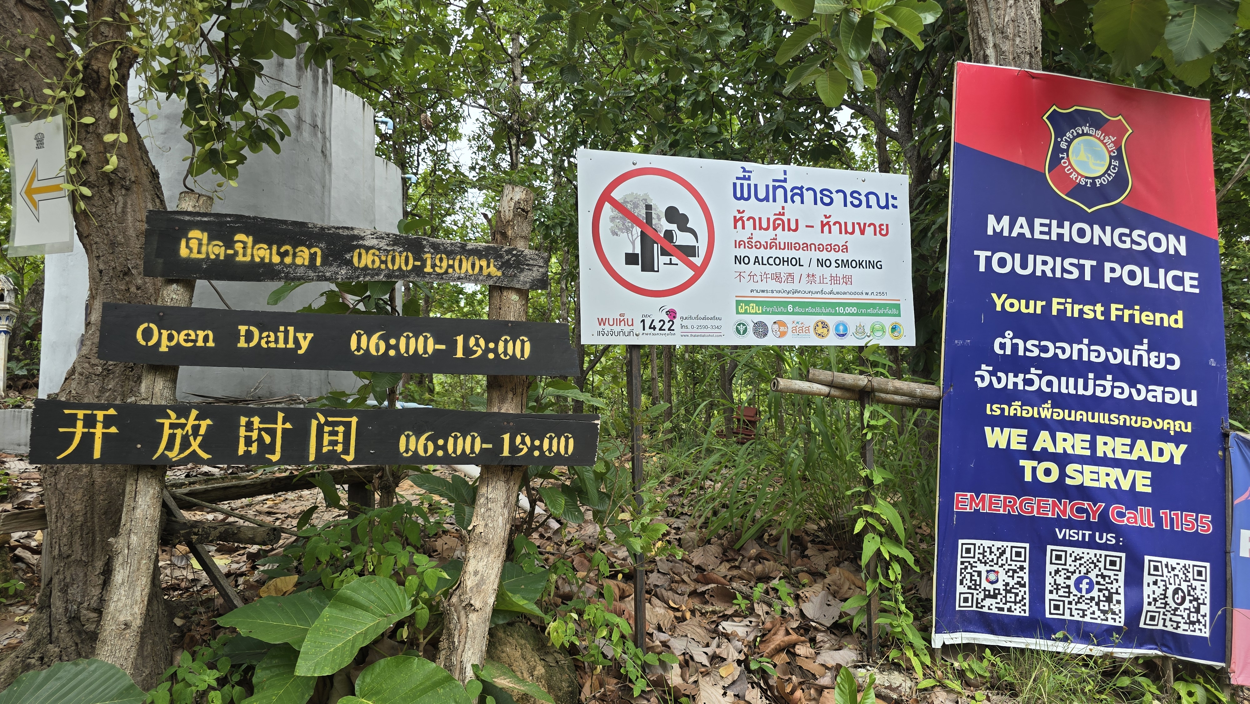
06:00 – 19:00

  • Every day (Mon–Sun)06:00–19:00
  • Best light17:00–18:30 (sunset)
🎟️

Pai Canyon Entrance Fee & Parking

  • Entrance fee
    Free admission — there is no ticket booth, you simply walk in.
  • Parking
    Roadside lot beside the entrance; a small local collection fee may apply, so bring small cash. It fills up around sunset.
  • Guides
    Not required — the trail is self-guided and unmarked in places.
🛣️

How to Get to Pai Canyon & Location

  • From Pai town
    About 8 km south on Route 1095 toward Mae Hong Son. Easily reached by motorbike, songthaew (shared pickup) or taxi in 15–20 minutes
  • From Chiang Mai
    Around 3–3.5 hours by minivan or car (762 curves on the famous road). Many travelers base in Pai and visit the canyon at sunset
  • From the airport
    The nearest airport is Chiang Mai International (CNX), about 3–3.5 hours' drive from Pai (the 762-curve road). After landing, take a minivan or private car to Pai town, then a songthaew or motorbike 8 km south on Route 1095. Pai's own airport (PYY) has only a few, mostly seasonal flights — from there it is likewise about 8 km south
  • By motorbike
    The most popular option — rent in Pai and follow the signs to 'Pai Canyon / Kong Lan'. Watch the curves and the heat
  • Coordinates
    19.3061° N, 98.4525° E (Plus Code 8F43+F22) — paste into any map app

Address: 8F43+F22, Mae Hi, Pai District, Mae Hong Son 58130, Thailand

Plus Code: 8F43+F22

Open route in Google Maps

Photography & Light Guide

Pai Canyon is a photographer's dream: copper ridges at golden hour, long valley shadows and a huge sunset sky

Best light windows

06:00 – 07:30

Sunrise — soft light, cool air and few people; the east valley glows as mist lifts

16:30 – 18:30

Golden hour — the laterite walls turn copper-red, the classic Pai Canyon shot

18:30 – 19:20

Blue hour — deep skies after sunset, great for silhouettes of the ridge

3 golden spots

The main overlook

View: Wide valley panorama with the red fins in the foreground — the postcard frame

Composition: Use a wide lens; arrive 45 min early to claim the spot before the crowd

The narrow ridge

View: A person walking the thin fin with drops both sides — dramatic sense of scale

Composition: Shoot low with a tele lens to compress the ridge; never step back for the shot

The ladder section

View: Rustic wooden ladder against red earth — texture and leading lines

Composition: Side-light at golden hour brings out the cracks in the laterite

Camera & phone settings

Golden-hour ridges (landscape)

Camera: f/8–f/11 · ISO 100 · 1/125s · wide 16–35mm · small aperture for depth

Phone: Tap to expose for the sky, drop exposure slightly; use 0.5× wide for the panorama

Silhouette at blue hour

Camera: f/4 · ISO 400 · 1/60s · shoot toward the afterglow

Phone: Night mode off; tap the bright horizon, lock focus, fire before full dark

Gear & safety tips

  • The ridge is exposed — bring water; midday heat is brutal with no shade
  • Wear grippy shoes; the red clay is slick after rain
  • A polariser deepens the sky and tames glare on the laterite
  • Never back up for a shot — the edge is a vertical drop

Best Season

Pai has three broad moods — cool and clear is best, hot is intense, wet is green but slippery

Cool Nov – Feb

Most comfortable · clear skies

Coolest, driest and busiest time. Crisp mornings and glowing sunsets — ideal for the canyon. Book Pai stays ahead

Hot Mar – May

Intense heat · go early/late

Very hot midday with flat light; visit at sunrise or sunset and carry water. The ridges can be slippery-dry and dusty

Wet Jun – Oct

Green & quiet · slippery

Lush and uncrowded, but the red clay turns slick after rain and storms can roll in fast. Good shoes and caution essential

Pai Canyon Hiking & Sunset Safety Tips

  • Narrow fins, open drops — The ridge paths are narrow with no guardrail and fall away on both sides — keep children close, walk single file and skip the fins if you fear heights
  • Wear grippy shoes — Red laterite turns to slick clay after rain — trainers or hiking shoes with real tread; flip-flops, sandals and bare feet are a bad idea
  • Sunset descent in the dark — Light fades fast once the sun drops — start walking back before the last light, keep a phone torch handy and never climb the fins in the dark
  • Heat & water — Almost no shade on the ridge — bring water and avoid the midday sun
  • Rainy-season gullies — In the wet months the soil erodes and the gullies get slippery — stay clear of freshly cracked edges and check the sky before setting off

⚠️ Haze / burning season

From late February to April, Northern Thailand enters the agricultural burning season. Haze settles in the valleys, PM2.5 levels rise and the setting sun can turn a dull red with reduced visibility. If you visit then, bring an anti-haze mask (N95) and check the live air quality (AQI) before you go.

🚑 Emergency & rescue

The ridge has no guardrails — save these numbers on your phone just in case:

Accessibility

The main viewpoint is easy; the ridge trail is not for everyone

  • Easy viewpoint — A short, mostly flat walk from the road leads to the main overlook — fine for most visitors
  • Not step-free throughout — The ridge has a wooden ladder and uneven earth; not wheelchair-friendly and tricky for very young kids
  • Facilities — Small roadside parking and a few local drink stalls near the entrance; no toilets right at the rim

Frequently Asked Questions

When is the best time to visit Pai Canyon +

Sunrise and sunset are best — cool light and few crowds. Avoid midday heat. Cool season (Nov–Feb) has the clearest skies.

Is there an entry fee +

No — Pai Canyon is free to enter. There is a small roadside parking area that is usually free as well.

Is it safe for children +

The main viewpoint is fine, but the narrow ridge has steep open drops and a ladder. Keep kids close and skip the thin fin if they are small or you fear heights.

How do I get there from Pai town +

About 8 km south on Route 1095. Motorbike rental is most popular; songthaews and taxis also go. Paste the coordinates 19.3061, 98.4525 into your map app.

How long should I spend +

Most visitors spend 30–60 minutes — enough for the ridge walk and photos. Plan for sunset and you may stay longer as the light changes.

Where is Pai Canyon located +

Pai Canyon is located at 8F43+F22, Mae Hi, Pai District, Mae Hong Son 58130, Thailand (19.3061° N, 98.4525° E), about 8 km south of Pai town on Route 1095 toward Mae Hong Son.

What should I wear and bring to Pai Canyon +

Wear shoes with good grip — the red laterite turns slick after rain. Bring drinking water, a hat and sunscreen: the ridge is almost entirely unshaded.

Can I watch sunrise at Pai Canyon +

Yes. The site is open daily from 06:00 to 19:00, so sunrise is possible and far less crowded than the famous sunset; the light on the east-facing gullies is soft and cool.

Facilities

Visitor Services & Facilities Around Pai Canyon

A practical, neutral overview of the kinds of services you can expect near the canyon and in the surrounding district, so you know what to carry and what to buy before you set off.

This section describes categories of services only. As a non-commercial educational project we do not name, rank or recommend individual businesses, and we have no commercial relationship with any operator.

🚻

Toilets (WC)

Basic toilets operate next to the parking area and the entrance stalls. There are none along the ridge itself, and none of the route has running water or hand-washing points.

Carry tissues and a little change

🅿️

Parking

An unpaved parking area sits beside the entrance. It is comfortable most of the day and completely full during the sunset peak, when vehicles also line the roadside.

Arrive 45+ min before sunset

🥤

Drinks & snack stalls

Small stalls and drinks carts cluster around the entrance, typically selling bottled water, soft drinks, coffee and simple local snacks. They run to the end of the sunset shift and are seasonal.

Bring a refillable bottle

🍜

Restaurants & cafés

Types available within a short drive: northern Thai family restaurants, simple noodle kitchens, coffee shops and a few vegetarian-friendly cafés. The widest choice is in Pai town rather than beside the canyon.

Best choice is 8 km away in town

🛏️

Accommodation

Types available: guesthouses, hostels, boutique resorts and hillside cabins. Almost all of it sits in Pai town and the surrounding valleys, so the canyon is always visited as a short trip rather than an overnight stay.

No lodging on the ridge

🛒

Shops, groceries & pharmacies

Types available in Pai town: convenience stores, grocery shops, pharmacies and a weekly market. Nothing is sold on the ridge beyond the entrance stalls, so stock up before you leave town.

Last supplies before the ridge

Fuel & EV charging

Types available: petrol stations along Route 1095 and in Pai town, plus an increasing number of charging points for electric vehicles and e-scooters operated by hotels and rental shops.

Fill up in town first

📶

Signal, ATMs & medical help

Mobile data is usable around the entrance and patchy on the ridge. ATMs and banks are in Pai town, and the district hospital with an emergency department is roughly 8–10 km away.

Emergency 191 · ambulance 1669

Facilities change with the season and with how busy the site is. Treat this as a checklist of what to prepare rather than a guarantee of what will be open on the day.

Food

Food & Drink Around Pai

Northern Thai and Burmese flavours in laid-back Pai town — a short drive from the canyon

Northern
Khao Soi from 60 ฿

Coconut curry noodle soup with crispy noodles — Northern Thailand's signature dish

Northern
Sai Ua from 80 ฿

Herbed Northern Thai sausage, grilled and served with chili dipping sauce

Burmese
Lahpet (tea-leaf salad) from 70 ฿

Fermented tea leaves with peanuts and sesame — a legacy of Pai's Shan-Burmese roots

Drinks
Fresh fruit shakes from 50 ฿

Mango, banana and dragonfruit shakes from the night-market stalls

Cafe
Coffee & bakeries from 60 ฿

Pai's cafe scene is famous — flat whites, sourdough and vegan treats all day

Food & Drink Around Pai
“Sunset at the canyon, then khao soi at the night market — that's a perfect Pai day”
— — A traveler on the Walking Street

Weather

Live Weather & 7-Day Forecast at Pai Canyon

The ridge is fully exposed to sun, wind and rain, so the forecast decides how you pack. Check the next few hours before you ride out from Pai town.

Right now at the canyon Updated 15:28
🌦️
31 °C
Light drizzle

Right now

🌡️ Feels like
35 °C
💧 Humidity
54 %
💨 Wind
8 km/h
🌧️ Chance of rain
94 %
🔆 UV index
Very high
🌅 Sunrise / Sunset
13:13 / 01:29

Do I need an umbrella?

Take an umbrella or a rain shell — rain is likely within the next few hours.

👕What to wear

Rain expected: a waterproof or quick-dry layer plus closed, grippy shoes — the canyon’s red soil turns slick when wet.

🧭How to plan the day

Rain is likely: move the ridge walk and sunset viewing earlier or to another day, and keep an indoor plan in Pai town as backup.

🎒What to pack

  • Rain jacket or a folding umbrella (ridge winds make long umbrellas useless)
  • Closed grippy shoes — red soil and loose gravel; flip-flops, sandals and bare feet are a bad idea
  • Sunscreen, sunglasses, a hat
  • Plenty of drinking water (there is no shop on the ridge)

Forecasts for mountain terrain are indicative, not guarantees: canyon weather can change within an hour. Carry water, tell someone your plan and keep an eye on the sky.

Next 7 days

Today
🌦️
32° / 22°
🌧️ 94%
Drizzle
Tomorrow
⛈️
32° / 22°
🌧️ 100%
Storm
Wed
⛈️
31° / 22°
🌧️ 96%
Storm
Thu
⛈️
30° / 23°
🌧️ 96%
Storm
Fri
⛈️
26° / 23°
🌧️ 99%
Storm
Sat
🌦️
31° / 22°
🌧️ 96%
Drizzle
Sun
🌦️
31° / 21°
🌧️ 100%
Drizzle

Reviews

What Visitors Say

A summary of traveler opinions on Google Maps to help you plan

★★★★★ 4.5 8,368 Google Maps user reviews

Rating and review count synced from Google Maps (Google Maps) user reviews · September 2026 · View all reviews on Google Maps ↗

Synced from Google Maps user reviews, synced September 2026; copyright belongs to the original authors and Google Maps.

As a non-profit educational site we present both the highlights and the cautions, straight.

“The sunset here is unreal — the whole canyon glows red and the valley goes quiet. A highlight of Pai.”
— Summarised from Google Maps
“Easy to reach but thrilling. The narrow ridge with drops on both sides got my heart racing.”
— Summarised from Google Maps
★★★★★

Came for sunset and stayed till dark — the colours were incredible.

Emma L. Mar 2026
★★★★★

Fun little hike along the ridge. Wear proper shoes; some parts are slippery.

Somchai Y. Feb 2026
★★★★☆

Beautiful but not for the faint-hearted — the path is narrow with steep drops.

David P. Jan 2026
★★★★★

Best free viewpoint near Pai. Arrive before 6pm to catch the golden light.

Nina K. Dec 2025
★★★★☆

Went at noon and it was blazing hot. Go early or late for sure.

Aiko T. Nov 2025
★★★★★

Loved the maze-like gullies. Took so many photos.

Tom B. Oct 2025
★★★★☆

Family visit — kids were nervous on the narrow bits, so we stuck to the viewpoint.

Jira W. Sep 2025
★★★★★

Quiet and free. Bring water and don't underestimate the heat.

Witthaya T. Aug 2025

Sources

Sources & Image Credits

This site is a non-profit educational project. Content is compiled from public sources, and photos are used under Creative Commons (CC) licences; copyright belongs to the original owners. If anything is missing or wrong, let us know.

Photo Licences

All photos displayed on this website remain the property of their original photographers; all rights reserved.

Facts & Information

Place, geology and history information references public sources including the Tourism Authority of Thailand (TAT), the Thai Meteorological Department climate normals for Mae Hong Son Province (1991–2020) and Wikipedia (Pai District). Live conditions and the multi-day outlook shown on this page are refreshed automatically from a weather data service.

Reviews · Synced September 2026

Synced from Google Maps user reviews, synced September 2026; copyright belongs to the original authors and Google Maps.

View all reviews on Google Maps ↗

Found a mistake? Let us know

We try to keep information accurate, but entry fees and opening hours can change. If you spot any error, email us so we can fix it for every traveler.

Email a correction

© 2026 Pai Canyon Guide

Map

Location & How to Visit Pai Canyon in Pai

In Mae Hi, Pai District, Mae Hong Son — about 8 km south of Pai town along Route 1095 toward Mae Hong Son.

Province
Mae Hong Son
Thailand

📍 Mae Hi, Pai District, Mae Hong Son 58130 (Plus Code 8F43+F22), about 8 km south of Pai town

📞 +66 86 113 7373

🧭 8F43+F22

🌐 19.3061° N, 98.4525° E

Coordinates
19.3061, 98.4525
19.3061° N, 98.4525° E
Distance
~8 km from Pai
20 min by motorbike (south on Rte 1095)

For official updates and regional tourism information, visit Tourism Authority of Thailand (TAT) ↗

Open in Google Maps Call